

Sognefjord 360°: hike + kayak + bike without transfers
The awe-inspiring Sognefjord is not only the longest and deepest fjord in Europe, but also a sight to behold. Stretching an impressive 204 km inland, it branches into a dozen arms, creating a majestic natural wonder that is sure to leave you in awe. But instead of the hassle of moving around, you can set up camp within a 30 km radius and tackle a new peak, a new bike trail or a fresh kayak mile every day – how great is that?!
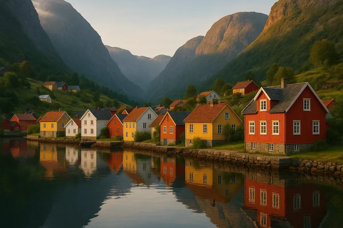
A base in Aurland, Sognadal or Balestrand is the perfect location for exploring Norway's stunning natural beauty. You'll be able to access some of the country's most breathtaking hiking trails, including the famous Rallarvegen cycle route, and the narrow Nærøyfjord, where you can experience the incredible kayaking tours that the country has to offer! The Sognefjord 360° format is the key to saving time and energy! All you need is one bed and one backpack, and you're ready for the adventure of a lifetime!
Why not go for a "one camp + day trips" trip instead of a cruise marathon?
One-day trips are easier to organise: no need to pack your things every day, look for a new campsite or check ferry schedules. Sognefjord ferries run early in the morning and in the evening, so you can just leave your luggage at the hostel and then decide how to combine boat, trail and bike routes in any order you like. Travellers on TripAdvisor Norway say that "camping compass" saved them up to 20% of their budget and a full day of travel time.
Base No. 1 is Aurland, which is the place to go if you want to visit Nærøyfjord and Rallarvegen.
Aurland is on the Bergen-Sogndal regional bus route. It's only 15 minutes to Flåm (and you can load your bikes onto the electric bus for free) and the same to the Flåm to Gudvangen cabin catamaran pier. In the village itself, you can hire sea kayaks and e-bikes, and there's a supermarket and a campsite with panoramic tent platforms. It's just three kilometres to the start of the Prest hike (1,478 m), one of Norway's most Instagrammable national park hikes.
On the first day, we're going to be doing a hike up Molden, which is 1,118 metres high.
The hike starts in the village of Hafslo and goes along coniferous slopes to an open ridge. The trail is 4.2 km long and goes up 600 m, and it's well maintained with red dots marking the way, so it's great for families with kids. The summit offers a 200-degree panorama of Lystrafjord, which locals like to call "nowhere else can you see so much of Sognefjord at once".
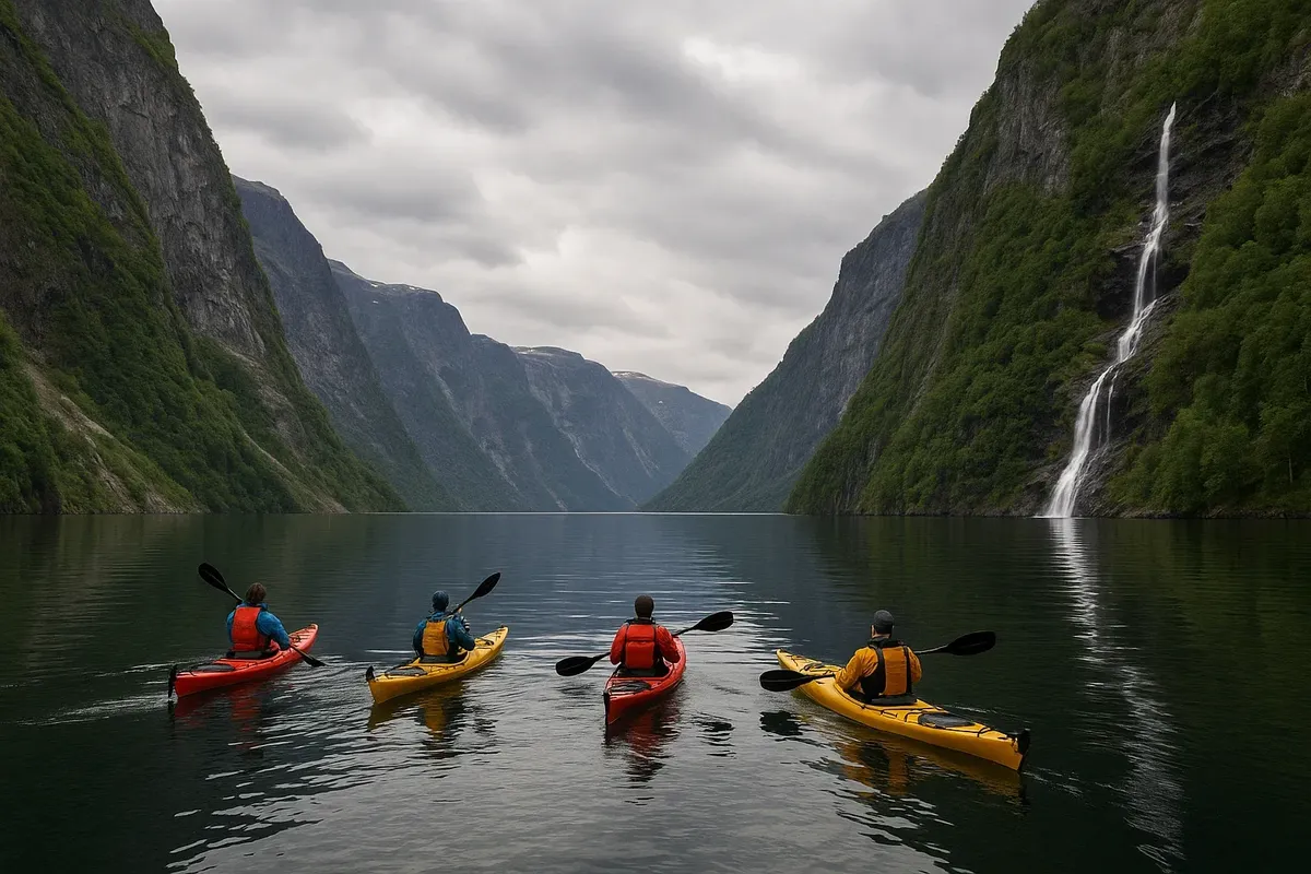
On day 2, we did some kayaking on Aurlandsfjord and Nærøyfjord.
Guided tours start from Flåm and Gudvangen, and in 4–6 hours, you'll cover 12–18 km in the calm waters of the fjords, which are included in the UNESCO World Heritage List. On the way, you'll see waterfalls and the ruins of old pastures. Nordic Ventures and Fjords.com are two tour companies that provide dry bags and warm neoprene skirts. The skill level is pretty basic – the water is sheltered from the wind, and if it gets stormy, a catamaran will pick up the group on the way back.
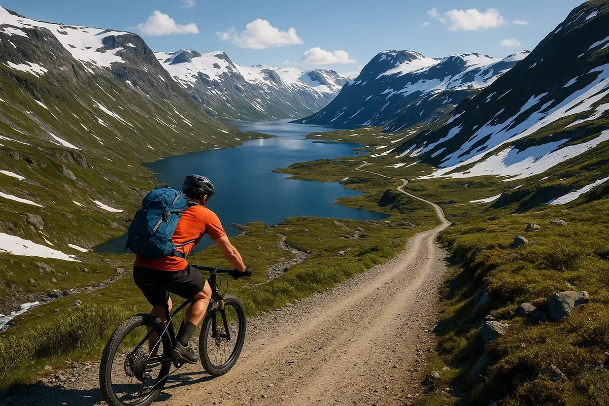
On the third day, we did the Rallarvegen bike ride from Finse to Flåm.
The morning train will take you and your bike to Fjorde station (1,222 m). Then it's 57 km of signature gravel: lakes, tunnels, snowfields and a 1,350 m descent to the fjord. Halfway along the route, stop for waffles in Vatnahalsen. Fjord Cycling will collect your bike from Flåm station, so you don't have to take it on the train back.
On the fourth day, we went from Balestrand to Vik by boat and bike.
A compact Fjord X cruise will take you to Vik, where you can see the carved Stave Church XII. The return journey is 32 km along a quiet road through apple orchards, offering new views of the main fjord every hour. Electric bikes give you an extra 80 km of range, which makes the route perfect for beginners.
What should you bring with you, and what can you rent when you get there?
You can hire all of the following in Aurland: sea kayak for 720 NOK per day, e-bike for 650 NOK, trekking poles for 50 NOK. Things you might want to take with you:
- A light down jacket (even in July, it can get down to +6°C in the evenings)
- Fingerless gloves for the descent down Rallarvegen
- A 20-litre dry bag You'll definitely need a power bank: your phone's going to be your ticket, navigation device and camera.
How do you coordinate ferry and bus schedules?
The Entur app shows all departures as they happen. Just select the "Bike allowed" filter and you'll see the ferries with bike racks. You can only take kayaks on deck in the "low rack" (length ≤ 5 m), and for anything longer there's an extra charge of 150 NOK. If you want to travel from Flåm to Gudvangen on the catamaran in high season, you should get your tickets 48 hours in advance.
So, what's the best time to go, then, in terms of the season and the weather?
From May to September, you can do all the activities (hiking, biking, kayaking) at the same time. June is the peak of the fruit orchard blossoming season; July brings warm water (+15°C) to Lystrafjord; August-September are famous for their stable "blue hour" for photography and less traffic on the trails. Rallarvegen officially opens on 10 July, but there's still snow on the pass until then.
Sognefjord 360° is an amazing format where you get to choose your mode of transport each morning. Do you want to go on foot, on bike or on water? The view changes, but the location remains the same: one shore, one cosy base and an endless collection of stunning landscapes.
We can't wait to hear all about your "fjord-to-summit" adventures! Make sure you write them down in your diary and share your GPX files with us. We're also super excited to hear your brilliant life hacks for coordinating schedules and the best spots for coffee breaks on the water! We're so excited to tell you that we're putting the final touches to the most comprehensive guide to outdoor adventures in Norway! We can't wait for tomorrow when Sognefjord enthusiasts will be able to pedal and paddle with your route in their favourites.

2 comments
Log in to leave a comment
Hva ville være drømmen for deg i å se Sognefjord fra flere perspektiver? 😊