

🪨 Geology beneath your feet: how glaciers carved out fjords and troges 🥾
Norway's national parks are simply amazing! They're like an open-air geology textbook, full of incredible natural wonders. As you walk along the trails, you will be amazed at how glaciers have shaped dramatic fjords, karst pits and rocky moraines. Discover the incredible history of the landscape with the iGeology Norway app – your key to unlocking a whole new world of adventure and meaning when you're out hiking.
Why are Jotunheimen and Jostedalsbreen great places for geological walks?
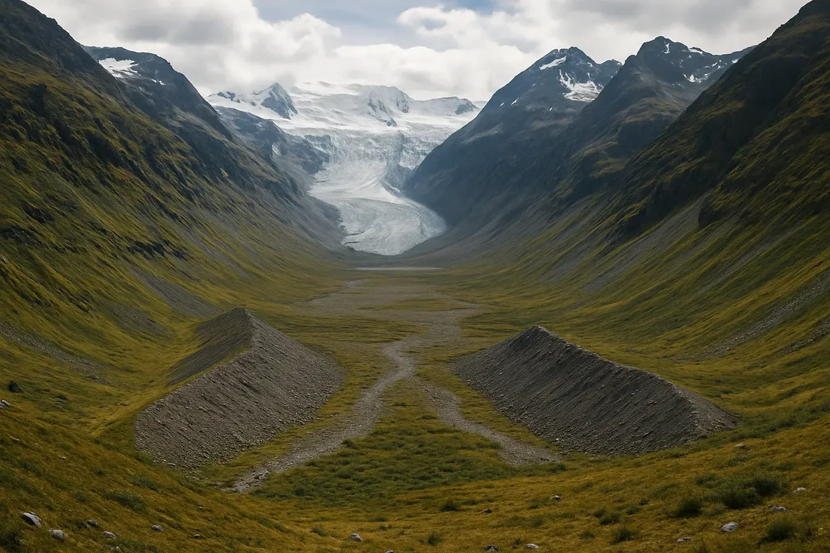
Jotunheimen is known for its amazing glacial formations, like cirques and moraine ridges. Jostedalsbreen, the largest glacier on the European mainland, shows how glacial ice can carve deep fjords and troughs into rock.
Which geographical features can you see on the paths in the national parks?
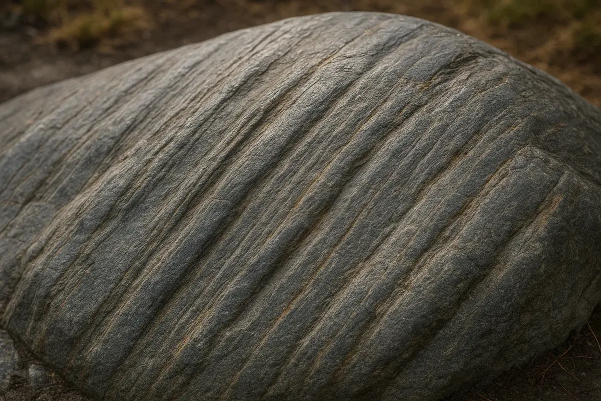
Along the way, you will see cirques (amphitheatre-shaped depressions), moraines (rocky ridges left behind by glaciers), hanging valleys, polished rocks ('sheep's heads') and characteristic U-shaped valleys, which form the famous fjords.
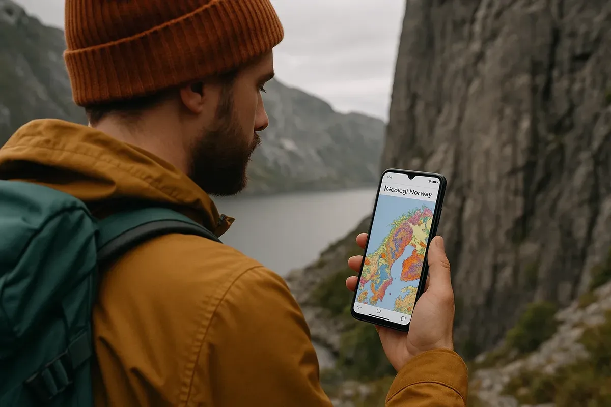
What does the iGeology Norway app do to help you understand the geology of the route?
The iGeology Norway app has maps of the layers of rock and the landscapes. You can use the app even when you are not connected to the internet. While you're hiking, you can identify the type of rock under your feet, find out how old it is and learn how the landscape around you was formed.
What safety issues need to be considered on geological trails?
Be especially careful in areas where rocks fall off the mountains, where there are holes in the ice and where there are cracks in the earth. Make sure you check the weather forecast and wear sturdy shoes that grip well, as mountain trails can be slippery and unstable.
Which animals can you usually find along geological routes?
On these routes, you may see reindeer, moose and birds that live in the mountains, such as white grouse. Stay back and stay calm so you don't startle the animals, and enjoy your time with them.
Which campsites or huts are best for geological walks?
The Gjendesheim (Jotunheimen) and Melkevoll Bretun (Jostedalsbreen) huts are great places to stay when you're out hiking and exploring the area's geology. From there, you can easily set off on day trips to explore the unique landscape around you.
How should I get ready for geological hiking?
Download offline maps from iGeology Norway before you go, and bring sturdy shoes, a map of the area, a GPS device, and a smartphone with a fully charged battery. Also, bring a small notebook or your phone so you can take notes on the geological formations you find.
Travelling along Norway's geological trails is an incredible opportunity to get up close and personal with the history of the Earth! You'll understand how nature created the unique landscapes that have become the country's calling card. Get ready for the most amazing outdoor adventure ever! Use modern tools to make your experience not only spectacular but educational too.
Have you already explored the incredible geology of Norway's stunning national parks? We can't wait to see your discoveries, tips and photos in the comments! We'll be publishing the most riveting stories in our catalogue to inspire others to go on geological trips in Norway.

2 comments
Log in to leave a comment