But what exactly is Atlantic Road, and why is it such a must-see?
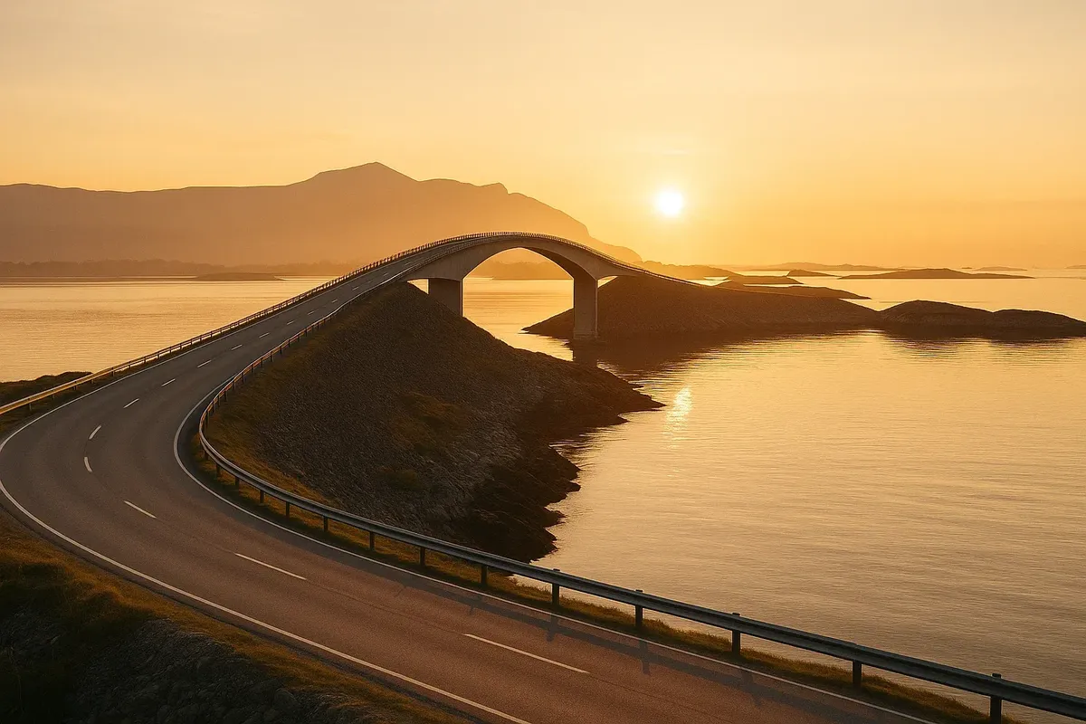
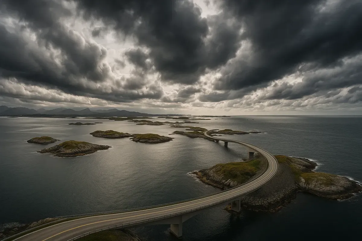
The stunning Atlanterhavsveien connects the beautiful islands of the Hustadvika archipelago with eight bridges that curve directly over the mighty Atlantic Ocean! Prepare to be amazed as you journey along this 8.3-kilometre stretch, where breathtaking vistas of storms, sunsets and seagulls come alive before your eyes. The British newspaper The Guardian has hailed this remarkable route as "the best road in the world" for travelling, and we can see why!
| Time |
What to do |
Why now |
| 07:30 |
Arrival in Kårvåg – the southern “gateway” to the road |
Sunrise paints the Storseisundet Bridge copper |
| 08:00 |
Breakfast at Svevestien Café (skillingsbolle buns and coffee) |
View of the bridge and soft morning light |
| 09:00 |
Slow drive along the road, stops at Storholmen & Geitøya viewpoints |
Almost no cars, perfect light |
| 11:00 |
Fishing from the pier at Myrbærholmen (rental 120 NOK/hr) |
Mackerel and cod close to shore |
| 13:00 |
Lunch at Bjartmars Favorittkro (navaga burger) |
Local catch + free Wi-Fi |
| 14:00 |
Svevestien walking trail (1.5 km boardwalks) |
Wide-angle shots of bridges |
| 16:00 |
Drive to Bud (25 km south) – old fort & waffle café |
Sunny midday, calm ocean |
| 18:00 |
Return to Storseisundet Bridge for golden hour |
Best colours 18:45–19:45 (June–Aug) |
| 20:00 |
Dinner at Håholmen Havstuer (8 min boat) |
18th-c fishing village vibe |
| 22:00 |
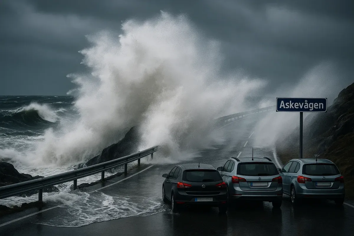
Storm spot at Askevågen harbour |
Waves “lick” the bridge |
| 23:30 |
Night at Kronborg Camping (cabin with ocean view) |
Fall asleep to surf sounds |
| 06:00 (day 2) |
Early rise for return or Trollstigen |
Morning without tourist buses |
| Point |
Coordinates |
What you can see |
Life hack |
| Storseisundet Bridge Lookout |
63.0166 N, 7.3679 E |
Iconic “jumping” bridge |
Use ~50 mm lens to capture cliff perspective |
| Askevågen |
63.0212 N, 7.3628 E |
Low deck above water |
Tripod + 1–2 s exposure for “silky” water |
| Myrbærholmen |
63.0230 N, 7.3540 E |
View of three bridges |
Step onto wooden pier for best angle |
| Geitøya |
63.0184 N, 7.3595 E |
Rocks in the surf |
Wear grippy shoes—wet rocks are slippery |
Storm spots and safety rules
- The great thing about wet asphalt is that you only need to keep a distance of ≥ 4 seconds! The ocean spray makes the road slippery, which makes for an exciting ride!
- Red flag at Svevestien = storm ≥ 20 m/s. For the ultimate surfing experience, keep your feet firmly on the deck and let the waves carry you up to 10 m!
- Only park in the official parking spaces – that way you can be sure to get the best view of the action! The roadside is narrow, so make sure you keep your eye on the bus and not the cars!
- Drones are a fantastic addition to our skies, but to make sure everyone has an amazing experience, there are a few simple rules to follow. To ensure the best possible flying experience, drones should only be used from designated parking areas and kept to an altitude of less than 120 metres. Anyone who follows these simple rules can look forward to a fantastic flight, and if you're not, there might be a small fine of up to NOK 9,600.
- And the best part? Life jackets for children are available free of charge at Myrbærholmen!
| Location |
What to try |
Note |
| Svevestien Café |
Waffles with lingonberry jam |
Open 08:00–17:00, Wi-Fi |
| Bjartmars Favorittkro |
Burger with whitefish + sweet cider |
Behind the Kjeksa bridge, parking for 20 cars |
| Håholmen Havstuer |
Scallop soup |
Boat from Geitøya every 30 min |
| Circle K Molde |
Mer 150 kW charging station |
30 km east, café-motel |
| Need |
Service |
| Wave and wind forecast |
Windy (layer "Wave 24 h") |
| Road conditions on Rv64 |
Vegvesen Trafikk |
| EV charging |
PlugShare (filter "Hustadvika") |
| Audio guide |
Voice of Norway – Atlantic Road route |
| Expenses |
NOK |
| Breakfast + lunch |
2 |
| Fishing (2 hours) |
2 |
| Tropical coffee + waffles |
1 |
| Håholmen dinner (set menu) |
9 |
| Camping cabin |
790 |
| Total |
2 330 NOK ≈ €220 |
Pre-departure checklist
- I checked the wind forecast (and it was more than 12 m/s — double caution, which is great!)
- Downloading offline maps is a great idea! The only thing to watch out for is the connection, which can be a bit unstable in some places.
- I just love this photo I took of the boat schedule to Håholmen!
- I made sure I had plenty of SD cards and batteries — storms can be a bit draining, but I'm ready for it!
- I made sure to pack a warm jacket and waterproof trousers in the boot — the spray is salty, but that just adds to the fun!
The Atlantic Road is an eight-kilometre stretch of road that takes you through all of Norway. You'll see bridges, storms, fishing boats and the smell of iodine. Come at dawn, stay until the golden sunset, catch mackerel, drink coffee with a view of the endless ocean — and in just 24 hours you'll see why this route is considered the benchmark for the "dream road trip".


2 comments
Log in to leave a comment
Hvilke attraksjoner ville du prioritert på en familie-roadtrip? 🚙